चित्र:A38(M) Aston Expressway.jpg
_Aston_Expressway.jpg)
ए नमूना के साइज: २२० × १६५ पिक्सेल. अउरी रिजोल्यूशन: ३२० × २४० पिक्सेल | ६४० × ४८० पिक्सेल.
ओरिजनल फाइल (६४० × ४८० पिक्सेल, फाइल साइज: ५२ KB, MIME टाइप: image/jpeg)
_Aston_Expressway.jpg)
सारांश
| बिबरणA38(M) Aston Expressway.jpg | A38(M) For Birmingham - Near The End, Birmingham Skyline |
| तारीख | |
| स्रोत | From geograph.org.uk |
| लेखक | Roy Hughes |
| परमीशन (एह फाइल के दुबारा इस्तेमाल) |
Creative Commons Attribution Share-alike license 2.0 |
| एट्रीब्यूशन (required by the license) InfoField | Roy Hughes / A38(M) For Birmingham - Near The End, Birmingham Skyline / |
InfoField | Roy Hughes / A38(M) For Birmingham - Near The End, Birmingham Skyline |
| Camera location |   | View this and other nearby images on: OpenStreetMap |  52.495524; -1.887277 52.495524; -1.887277 |
|---|
_Aston_Expressway.jpg¶ms=052.495524_N_-001.887277_E_globe:Earth_type:camera_heading:202.00&language=bho)
लाइसेंसिंग

|
This image was taken from the Geograph project collection. See this photograph's page on the Geograph website for the photographer's contact details. The copyright on this image is owned by Roy Hughes and is licensed for reuse under the Creative Commons Attribution-ShareAlike 2.0 license.
|


This file is licensed under the Creative Commons Attribution-Share Alike 2.0 Generic license.
एट्रीब्यूशन:
Roy Hughes
- आप फ्री बानी:
- साझा करे खातिर – रचना के नकल करे, बाँटे आ दुसरी जगह भेजे खातिर
- रीमिक्स करे खातिर – काम के अपनी हिसाब से बनावे खातिर
- नीचे दिहल कारणन की तहत:
- एट्रीब्यूशन – लाइसेंस के कड़ी दे के उचित श्रेय (क्रेडिट) दिहल जरूरी बा आ अगर कौनों बदलाव कइल गइल बा तब ओहू के बतावल जाए के चाहीं। आप ई काम कौनों उचित तरीका से क सकत बानी, बाकी ई न झलके के चाहीं की जेकरा लगे लाइसेंस बा ऊ राउर चाहे राउर काम के समर्थन करत बाटे या सही बतावत बा।
- शेयर अलाइक (share alike) – अगर आप एह सामग्री के आधार बना के कुछ रिमिक्स करत बानी, रूप बदलाव करत बानी, चाहे कुछ जोड़ के सामग्री के बढ़ावत बानी, आपके आपन योगदान ठीक एही या कंपेटिबल लाइसेंस जइसन कि ओरिजनल बाटे, के तहत होखे के चाहीं।
Captions
Add a one-line explanation of what this file represents
A38(M) For Birmingham - Near The End, Birmingham Skyline
फाइल के इतिहास
ओ समय ई फाइल कइसन लउके ई देखे खातिर कौनों तारीख/समय पर क्लिक करीं।
| तारीख/समय | चिप्पी रूप | डाइमेंशन | प्रयोगकर्ता | टिप्पणी | |
|---|---|---|---|---|---|
| वर्तमान | ०१:५८, १२ जुलाई २००९ | 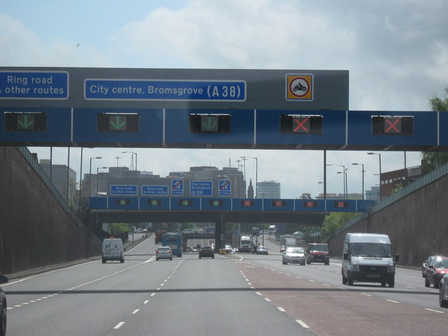 | ६४० × ४८० (५२ KB) | smartcommons>JimmyGuano | == Summary == {{Information |Description=A38(M) For Birmingham - Near The End, Birmingham Skyline |Source=From [http://www.geograph.org.uk/photo/1291182 geograph.org.uk] |Date=2009-05-06 |Author=[http://www.geograph.org.uk/profile/32682 Roy Hughes] |Permi |
फाइल के उपयोग
कौनों पन्ना नइखे जवन ए फाइल के इस्तेमाल करत होखे।
_Aston_Expressway.jpg)