चित्र:Brit IndianEmpireReligions3.jpg

ए नमूना के साइज: २२० × १७८ पिक्सेल. अउरी रिजोल्यूशन: २९७ × २४० पिक्सेल | १,५३४ × १,२४१ पिक्सेल.
ओरिजनल फाइल (१,५३४ × १,२४१ पिक्सेल, फाइल साइज: २.३३ MB, MIME टाइप: image/jpeg)
सारांश
| बिबरणBrit IndianEmpireReligions3.jpg |
English: Map "Prevailing Religions of the British Indian Empire, 1909" Key:
|
| तारीख | |
| स्रोत | The Imperial Gazetteer of India, Oxford University Press, 1909. Scanned from personal copy and annotated by me (Fowler&fowler«Talk» 04:16, 19 March 2007 (UTC)) |
| लेखक |
English: John George Bartholomew |
| Other versions |
.jpg) |

.jpg)


|
This old map image could be re-created using vector graphics as a SVG file. This has several advantages; see Commons:Media for cleanup for more information. If a SVG form of this image is available, please upload it and afterwards replace this template with
{{vector version available|new image name}}.It is recommended to name the SVG file “Brit IndianEmpireReligions3.svg”—then the template Vector version available (or Vva) does not need the new image name parameter. |


लाइसेंसिंग
| Public domainPublic domainfalsefalse |

|
The author died in 1920, so this work is in the public domain in its country of origin and other countries and areas where the copyright term is the author's life plus 100 years or fewer. This work is in the public domain in the United States because it was published (or registered with the U.S. Copyright Office) before January 1, 1931. |
| This file has been identified as being free of known restrictions under copyright law, including all related and neighboring rights. | |
https://creativecommons.org/publicdomain/mark/1.0/PDMCreative Commons Public Domain Mark 1.0falsefalse
Original upload log
The original description page was here. All following user names refer to en.wikipedia.

- 2007-03-19 04:16 Fowler&fowler 1650×1275×8 (338398 bytes) Map "Prevailing Religions of the British Indian Empire, 1909" from the Imperial Gazetteer of India, Oxford University Press, 1909. Scanned from personal copy and annotated by me (~~~~) {{PD-old-75}}
| Annotations InfoField | This image is annotated: View the annotations at Commons |

683
77
727
360
1534
1241
Tibet
1217
296
222
199
1534
1241
Kham
Captions
Add a one-line explanation of what this file represents
1909 Religious Map of India
फाइल के इतिहास
ओ समय ई फाइल कइसन लउके ई देखे खातिर कौनों तारीख/समय पर क्लिक करीं।
| तारीख/समय | चिप्पी रूप | डाइमेंशन | प्रयोगकर्ता | टिप्पणी | |
|---|---|---|---|---|---|
| वर्तमान | ०८:०९, १८ जनवरी २०१९ | 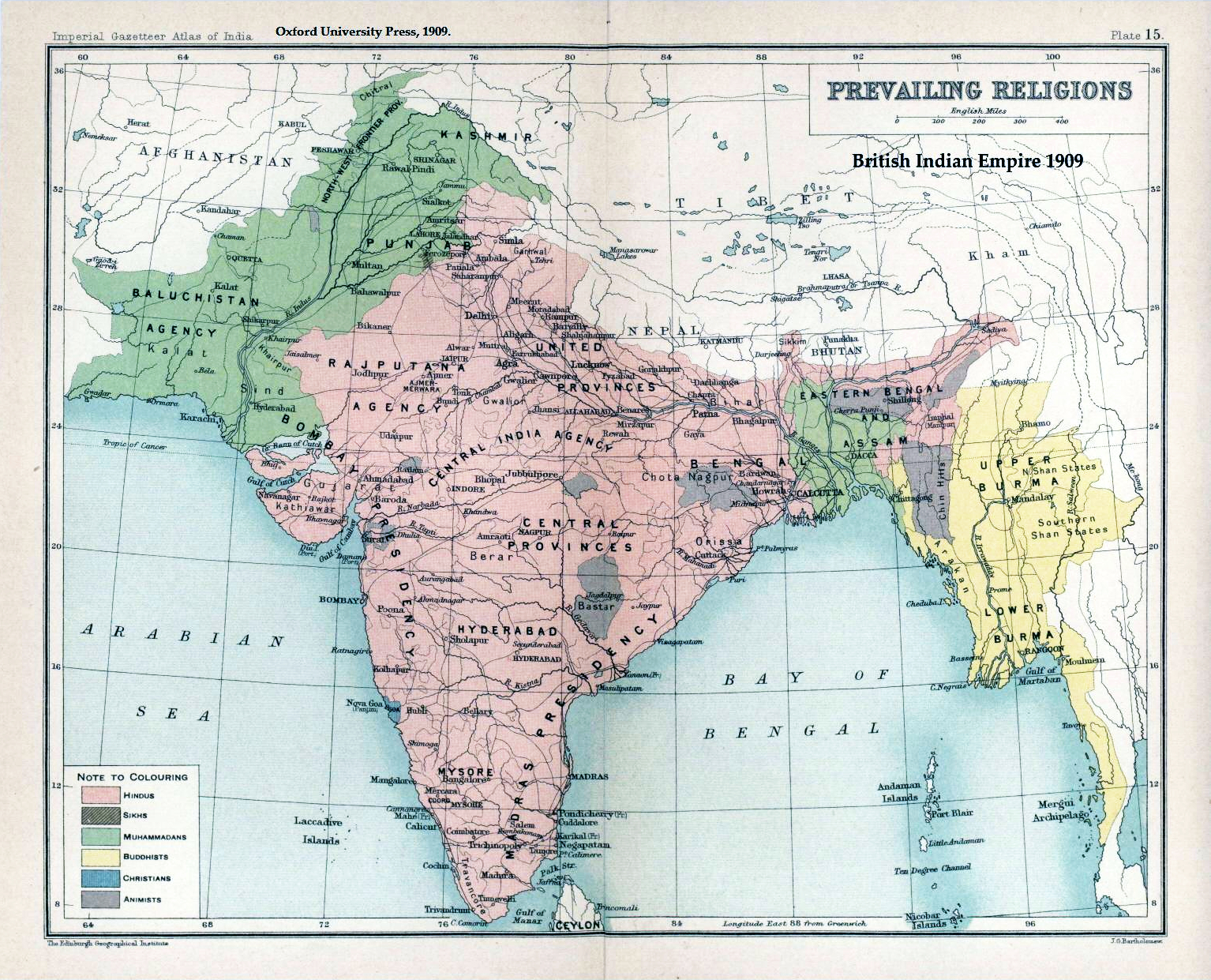 | १,५३४ × १,२४१ (२.३३ MB) | smartcommons>Frank Klemm | Cropped, white balanced |
फाइल के उपयोग
कौनों पन्ना नइखे जवन ए फाइल के इस्तेमाल करत होखे।
