चित्र:EN-WarringStatesAll260BCE.jpg

ए नमूना के साइज: २२० × २०२ पिक्सेल. अउरी रिजोल्यूशन: २६१ × २४० पिक्सेल | ४,७२४ × ४,३४८ पिक्सेल.
ओरिजनल फाइल (४,७२४ × ४,३४८ पिक्सेल, फाइल साइज: १.७७ MB, MIME टाइप: image/jpeg)
सारांश
| बिबरणEN-WarringStatesAll260BCE.jpg |
English: Political map of China during the Warring States period, circa 260 BCE |
| तारीख | |
| स्रोत | आपन रचना |
| लेखक | Philg88 |
| Other versions |
[]
|

-zhtw.png)


|
This historical map image could be re-created using vector graphics as a SVG file. This has several advantages; see Commons:Media for cleanup for more information. If a SVG form of this image is available, please upload it and afterwards replace this template with
{{vector version available|new image name}}.It is recommended to name the SVG file “EN-WarringStatesAll260BCE.svg”—then the template Vector version available (or Vva) does not need the new image name parameter. |


लाइसेंसिंग
I, the copyright holder of this work, hereby publish it under the following licenses:


ई फाइल Creative Commons Attribution-Share Alike 3.0 Unported लाइसेंस की तहत लाइसेंसी बा।
- आप फ्री बानी:
- साझा करे खातिर – रचना के नकल करे, बाँटे आ दुसरी जगह भेजे खातिर
- रीमिक्स करे खातिर – काम के अपनी हिसाब से बनावे खातिर
- नीचे दिहल कारणन की तहत:
- एट्रीब्यूशन – लाइसेंस के कड़ी दे के उचित श्रेय (क्रेडिट) दिहल जरूरी बा आ अगर कौनों बदलाव कइल गइल बा तब ओहू के बतावल जाए के चाहीं। आप ई काम कौनों उचित तरीका से क सकत बानी, बाकी ई न झलके के चाहीं की जेकरा लगे लाइसेंस बा ऊ राउर चाहे राउर काम के समर्थन करत बाटे या सही बतावत बा।
- शेयर अलाइक (share alike) – अगर आप एह सामग्री के आधार बना के कुछ रिमिक्स करत बानी, रूप बदलाव करत बानी, चाहे कुछ जोड़ के सामग्री के बढ़ावत बानी, आपके आपन योगदान ठीक एही या कंपेटिबल लाइसेंस जइसन कि ओरिजनल बाटे, के तहत होखे के चाहीं।

|
जीएनयू फ्री डाकुमेंटेशन लाइसेंस, वर्जन 1.2 या फिर कौनो भी बाद के प्रकाशित फ्री साफ्टवेयर फाउंडेशन लाइसेंस के शर्त के तहत, एह डाकुमेंट के नकल करे, बितरण करे आ/भा बदलाव करे के परमीशन दिहल गइल बा; एह में इनवैरिएंट खंड सभ नइखे शामिल, मुखपृष्ट के पाठ नइखे शामिल, आ बैक-कभर के पाठ नइखे शामिल। लाइसेंस के एगो प्रति जीएनयू फ्री डाकुमेंटेशन लाइसेंस नाँव के खंड में दिहल गइल बा।http://www.gnu.org/copyleft/fdl.htmlGFDLGNU Free Documentation Licensetruetrue |
रउआँ अपनी जरूरत के लाइसेंस बीछ सकत बानीं।
Captions
Add a one-line explanation of what this file represents
A political map of China during the Warring States period circa 260 BCE.
Karta över Kina under De Stridande Staternas period cirka 260 f.kr.
Kartta Kiinasta taistelevien läänitysvaltioiden aikana noin 260 eaa.
फाइल के इतिहास
ओ समय ई फाइल कइसन लउके ई देखे खातिर कौनों तारीख/समय पर क्लिक करीं।
| तारीख/समय | चिप्पी रूप | डाइमेंशन | प्रयोगकर्ता | टिप्पणी | |
|---|---|---|---|---|---|
| वर्तमान | २२:३०, १७ अक्टूबर २०१३ | 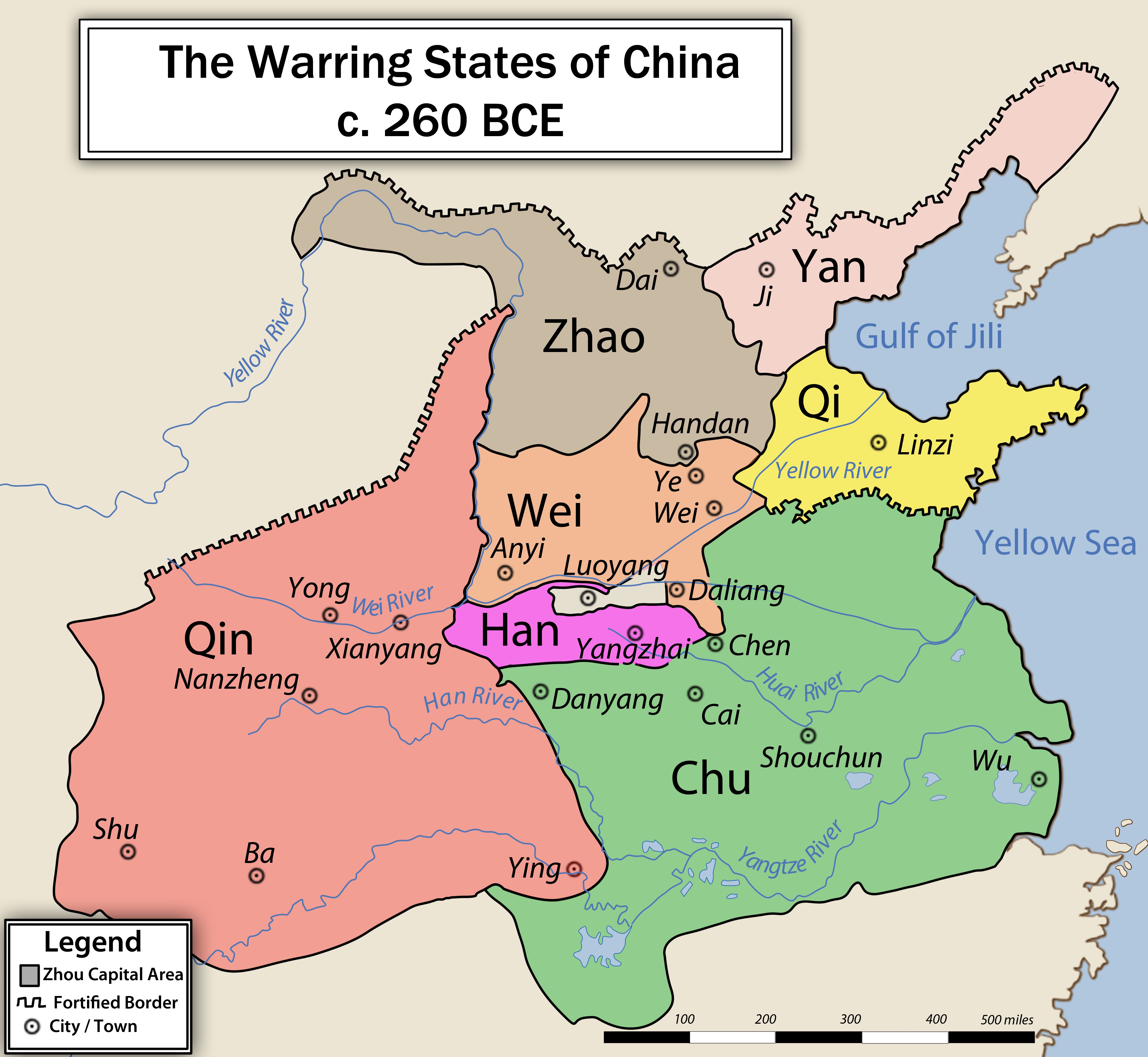 | ४,७२४ × ४,३४८ (१.७७ MB) | smartcommons>Iflwlou | change |
फाइल के उपयोग
कौनों पन्ना नइखे जवन ए फाइल के इस्तेमाल करत होखे।
