चित्र:Erdfunkstelle Raisting 2.jpg

ए नमूना के साइज: २२० × १९८ पिक्सेल. अउरी रिजोल्यूशन: २६६ × २४० पिक्सेल | २,२१९ × २,००० पिक्सेल.
ओरिजनल फाइल (२,२१९ × २,००० पिक्सेल, फाइल साइज: २.१६ MB, MIME टाइप: image/jpeg)
| बिबरणErdfunkstelle Raisting 2.jpg |
Deutsch: Die größte Erdfunkstelle der Welt bei Raisting (in der Nähe des Ammersees) ist eine Bodenstation für die Kommunikation mit Nachrichtensatelliten und ist mit ihren großen Parabolantennen weithin sichtbar.
English: Antenna 2, a 28.5 meters (94 ft) diameter parabolic satellite communication antenna at Erdfunkstelle Raisting (Raisting Earth Station) Raisting, Bavaria, the biggest satellite communication facility in Germany. It was built in 1969 by the German Federal Post Office to exchange global telecommunication traffic with the Intelsat communication satellites. This type of parabolic antenna is called a Cassegrain antenna. The radio waves emerge from the hole in the center of the dish and are focussed on a convex subreflector suspended on the supports in front of the dish. The waves are reflected back toward the main dish, which reflects them forward to form the outgoing beam aimed at the satellite. The antenna transmits on 6 GHz with a gain 64.2 dB and receives on 4 GHz with a gain of 60.2 dB. (information from https://radom-raisting.de/erdfunkstelle/antenne-2)
Français : Le plus gros centre de communication satellitaire à Raisting, en Bavière (Allemagne). |
| तारीख | |
| स्रोत | आपन रचना |
| लेखक |
Richard Bartz, Munich aka Makro Freak  |
| परमीशन (एह फाइल के दुबारा इस्तेमाल) |
   This file is licensed under the Creative Commons Attribution-Share Alike 2.5 Generic license.
|
| Other versions |
|


| Camera location |  | View this and other nearby images on: OpenStreetMap |  47.898611; 11.111667 47.898611; 11.111667 |
|---|
|


|
This image was selected as picture of the day on Wikimedia Commons for 9 June 2008. It was captioned as follows: Other languages:
Alemannisch: D'gröschti Erdfunksteu dr Weut bi Raisting, Düschtland. Bosanski: Najveća satelitska stanica u Raistingu (Bavarska, Njemačka). Čeština: Parabolická anténa největší pozemní stanice pro satelitní komunikaci v bavorském Raistingu (Německo) Dansk: Parabolantenne ved verdens største center for satellitkommunikation i Raisting, delstaten Bayern i Tyskland Esperanto: Parabola anteno de la plej granda surtera stacio por satelita komunikado en la bavara urbo Raisting, Germanujo Français : Le plus gros centre de communication satellitaire du monde à Raisting, en Bavière (Allemagne). Magyar: A világ legnagyobb parabolaantennája, amit műholdas kommunikációhoz használnak (Raisting, Bavaria, Németország) Nederlands: Een radiotelescoop op het Grondstation Raisting, het grootste grondstation voor satellietcommunicatie ter wereld, gelegen bij de gelijknamige Duitse plaats in Beieren Português: A maior antena parabólica da Alemanha, situada em Raisting, na Baviera, destinada a comunicações via satélite. Svenska: En stor parabolantenn vid världens största markstation för satellitkommunikation i Raisting i Bayern. Беларуская: Буйны вузел спадарожнікавай сувязі (Райстынг, Германія). 한국어: 독일 바이에른 주 라이스팅에 있는 큰 위성 통신 시설. |
Captions
Add a one-line explanation of what this file represents
A 28.5 m satellite communication antenna at Erdfunkstelle Raisting, a satellite ground station in Bavaria, Germany
फाइल के इतिहास
ओ समय ई फाइल कइसन लउके ई देखे खातिर कौनों तारीख/समय पर क्लिक करीं।
| तारीख/समय | चिप्पी रूप | डाइमेंशन | प्रयोगकर्ता | टिप्पणी | |
|---|---|---|---|---|---|
| वर्तमान | १५:०३, ३० मार्च २००८ | 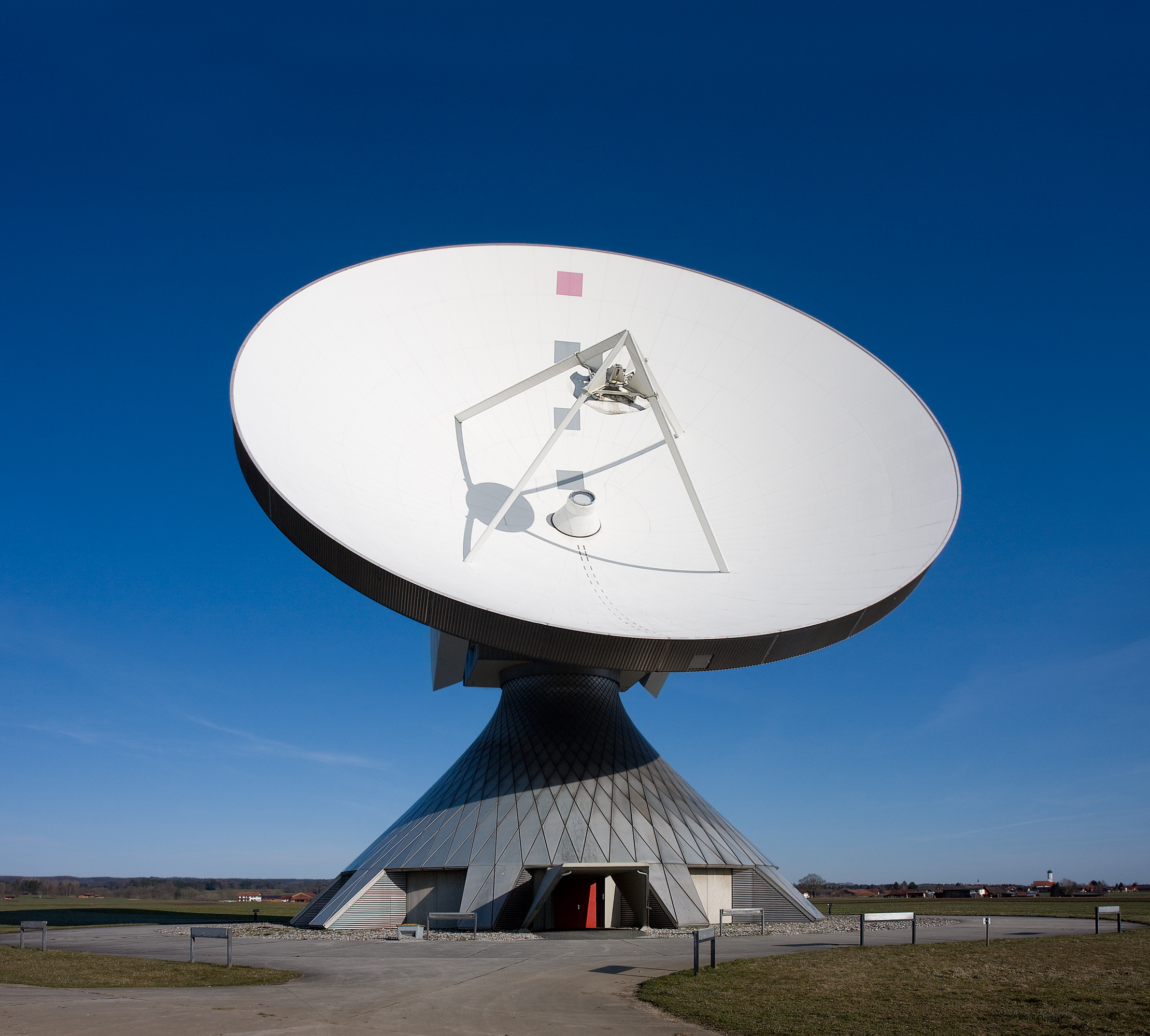 | २,२१९ × २,००० (२.१६ MB) | smartcommons>Richard Bartz | {{Information |Description = {{de|Die größte Erdfunkstelle der Welt bei Raisting (in der Nähe des Ammersees) ist eine Bodenstation für die Kommunikation mit Nachrichtensatelliten und ist mit ihren großen Parabolantennen weithin sichtbar.}} {{en|The b |
फाइल के उपयोग
कौनों पन्ना नइखे जवन ए फाइल के इस्तेमाल करत होखे।
