चित्र:FrontLines Environment Photo Contest Winner -5 (5808476109).jpg
.jpg)
ए नमूना के साइज: २२० × १४७ पिक्सेल. अउरी रिजोल्यूशन: ३२० × २१४ पिक्सेल | १,२८० × ८५४ पिक्सेल.
ओरिजनल फाइल (१,२८० × ८५४ पिक्सेल, फाइल साइज: ४३२ KB, MIME टाइप: image/jpeg)
सारांश
| बिबरणFrontLines Environment Photo Contest Winner -5 (5808476109).jpg | Here, a dramatic view of flood plain cultivation in Wakhan, Afghanistan. Known as "the roof of the world," the Wildlife Conservation Society says the Wakhan Corridor has few rivals in terms of scenic beauty. The little-known area is nestled in the high Pamir Mountains and the region is flanked by the Hindu Kush, Himalayn, Karakoram, and Kunlun ranges. Credit: John Winnie Jr., WCS-Afghanistan |
| तारीख | |
| स्रोत | FrontLines Environment Photo Contest Winner #5 |
| लेखक | USAID U.S. Agency for International Development |
| Camera location |  | View this and other nearby images on: OpenStreetMap |  36.952778; 72.962500 36.952778; 72.962500 |
|---|
| Object location | | View this and other nearby images on: OpenStreetMap | 36.951111; 72.962778 |
|---|

.jpg)
.jpg¶ms=036.952778_N_0072.962500_E_globe:Earth_type:camera__&language=bho)
.jpg¶ms=036.951111_N_0072.962778_E_globe:Earth_class:object_type:object__&language=bho)
- Notes on location estimate
- Identify village by shape of the farm field
लाइसेंसिंग
| Public domainPublic domainfalsefalse |

|
This image is a work of a United States Agency for International Development employee, taken or made as part of that person's official duties. As a work of the U.S. federal government, the image is in the public domain in the United States.
See also: The USAID privacy policy and the USAID Office of Inspector General "Disclaimers & Notices" page
|
 |

|
This image was originally posted to Flickr by USAID_IMAGES at https://flickr.com/photos/46658241@N06/5808476109. It was reviewed on ४ जनवरी २०१७ by FlickreviewR and was confirmed to be licensed under the terms of the United States Government Work. |
४ जनवरी २०१७
Captions
Add a one-line explanation of what this file represents
Village of Kret (Korut) with Wahkan River in the front and Koh-e Baba Tangi in the background
Вахандарья (Вахан-Дарья). Вид на левобережье нижнего течения Вахандарьи около населённого пункта Крыт
फाइल के इतिहास
ओ समय ई फाइल कइसन लउके ई देखे खातिर कौनों तारीख/समय पर क्लिक करीं।
| तारीख/समय | चिप्पी रूप | डाइमेंशन | प्रयोगकर्ता | टिप्पणी | |
|---|---|---|---|---|---|
| वर्तमान | ०७:३६, ४ जनवरी २०१७ | 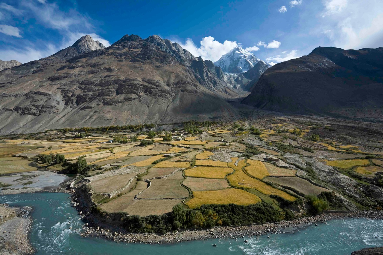 | १,२८० × ८५४ (४३२ KB) | smartcommons>Reguyla | Transferred from Flickr via Flickr2Commons |
फाइल के उपयोग
कौनों पन्ना नइखे जवन ए फाइल के इस्तेमाल करत होखे।
.jpg)