चित्र:Kathiawar map.jpg

ए नमूना के साइज: २२० × १५१ पिक्सेल. अउरी रिजोल्यूशन: ३२० × २१९ पिक्सेल | २,४९२ × १,७०७ पिक्सेल.
ओरिजनल फाइल (२,४९२ × १,७०७ पिक्सेल, फाइल साइज: २.८७ MB, MIME टाइप: image/jpeg)
सारांश
| DescriptionKathiawar map.jpg |
English: Map of Kathiawar |
|||||||||
| तारीख | ||||||||||
| स्रोत | Gazetteer of the Bombay Presidency. (1896) by James M. Campbell | |||||||||
| Creator |
Various |
|||||||||
| Geotemporal data | ||||||||||
| Bounding box |
|
|||||||||
| Georeferencing | ||||||||||


लाइसेंसिंग
| Public domainPublic domainfalsefalse |

|
This work is in the public domain in its country of origin and other countries and areas where the copyright term is the author's life plus 70 years or fewer. This work is in the public domain in the United States because it was published (or registered with the U.S. Copyright Office) before January 1, 1931. |
| This file has been identified as being free of known restrictions under copyright law, including all related and neighboring rights. | |
https://creativecommons.org/publicdomain/mark/1.0/PDMCreative Commons Public Domain Mark 1.0falsefalse
Captions
Add a one-line explanation of what this file represents
This Image contains 4 States of Kathiawar at the Time of 1878, which are Halaar, Jhalavad, Sorath and Gohelvad.
આ ચિત્ર માં કાઠીયાવાડ ના 4 અવિભાજિત અંગ દેખાડવામાં આઈવા છે જેમનું હાલાર, ઝાલાવાડ, ગોહેલવાદ અને સોરઠ શુભનામ છે
यह चित्र काठियावाड़ के चार अविभाजित भागों को दर्शाता है जिनके नाम हैं हालार, झालावाड़, गोहेलवाड़ और सोरठ।
फाइल के इतिहास
ओ समय ई फाइल कइसन लउके ई देखे खातिर कौनों तारीख/समय पर क्लिक करीं।
| तारीख/समय | चिप्पी रूप | डाइमेंशन | प्रयोगकर्ता | टिप्पणी | |
|---|---|---|---|---|---|
| वर्तमान | २०:४९, ५ नवंबर २०१४ | 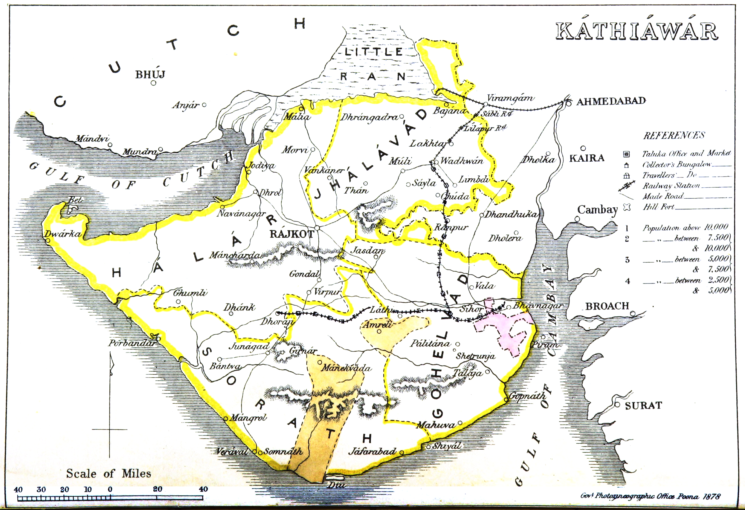 | २,४९२ × १,७०७ (२.८७ MB) | smartcommons>Shyamal | User created page with UploadWizard |
फाइल के उपयोग
कौनों पन्ना नइखे जवन ए फाइल के इस्तेमाल करत होखे।
