चित्र:Kongka Pass claim lines (1962).jpg
.jpg)
ए नमूना के साइज: २२० × १८५ पिक्सेल. अउरी रिजोल्यूशन: २८५ × २४० पिक्सेल | १,४४९ × १,२१९ पिक्सेल.
ओरिजनल फाइल (१,४४९ × १,२१९ पिक्सेल, फाइल साइज: ५५८ KB, MIME टाइप: image/jpeg)
सारांश
| बिबरणKongka Pass claim lines (1962).jpg |
English: 1956 claim line in green, 1960 claim line in dark brown, and 1962 ceasefire line orange
Legend:
|
| तारीख | |
| स्रोत | https://openresearch-repository.anu.edu.au/handle/1885/187645 |
| लेखक | US Army Headquarters, Survey Company |
| Other versions |


.jpg)
लाइसेंसिंग
| Public domainPublic domainfalsefalse |

|
This file is a work of a U.S. Army soldier or employee, taken or made as part of that person's official duties. As a work of the U.S. federal government, it is in the public domain in the United States.
|
 |
Captions
Add a one-line explanation of what this file represents
Chinese claim lines near the Kongka Pass
फाइल के इतिहास
ओ समय ई फाइल कइसन लउके ई देखे खातिर कौनों तारीख/समय पर क्लिक करीं।
| तारीख/समय | चिप्पी रूप | डाइमेंशन | प्रयोगकर्ता | टिप्पणी | |
|---|---|---|---|---|---|
| वर्तमान | २२:१६, २१ जून २०२२ | 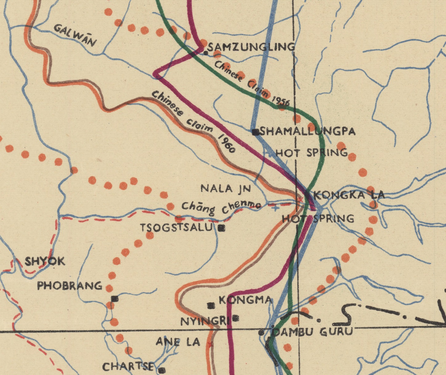 | १,४४९ × १,२१९ (५५८ KB) | smartcommons>Kautilya3 | Uploaded a work by US Army Headquarters, Survey Company from https://openresearch-repository.anu.edu.au/handle/1885/187645 with UploadWizard |
फाइल के उपयोग
कौनों पन्ना नइखे जवन ए फाइल के इस्तेमाल करत होखे।
.jpg)