चित्र:MX-DF-hidro.png

ए नमूना के साइज: २२० × २८५ पिक्सेल. अउरी रिजोल्यूशन: १८५ × २४० पिक्सेल | ८१६ × १,०५६ पिक्सेल.
ओरिजनल फाइल (८१६ × १,०५६ पिक्सेल, फाइल साइज: १२३ KB, MIME टाइप: image/png)

सारांश
| बिबरणMX-DF-hidro.png |
English: Hydrology map of Mexico City
Español: Mapa hidrológico del Distrito Federal de México |
| तारीख | १३ जून २००६ (original upload date) |
| स्रोत | No machine-readable source provided. Own work assumed (based on copyright claims). |
| लेखक | No machine-readable author provided. Yavidaxiu assumed (based on copyright claims). |
लाइसेंसिंग
| Public domainPublic domainfalsefalse |

|
I, the copyright holder of this work, release this work into the public domain. This applies worldwide. In some countries this may not be legally possible; if so: I grant anyone the right to use this work for any purpose, without any conditions, unless such conditions are required by law. |
Captions
Add a one-line explanation of what this file represents
फाइल के इतिहास
ओ समय ई फाइल कइसन लउके ई देखे खातिर कौनों तारीख/समय पर क्लिक करीं।
| तारीख/समय | चिप्पी रूप | डाइमेंशन | प्रयोगकर्ता | टिप्पणी | |
|---|---|---|---|---|---|
| वर्तमान | १९:४४, १३ जून २००६ | 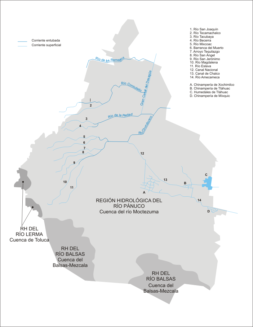 | ८१६ × १,०५६ (१२३ KB) | smartcommons>Yavidaxiu | Mapa hidrológico del Distrito Federal de México Category:Maps of Distrito Federal |
फाइल के उपयोग
कौनों पन्ना नइखे जवन ए फाइल के इस्तेमाल करत होखे।
