चित्र:Malabar 1854.jpg

ए नमूना के साइज: २२० × २५८ पिक्सेल. अउरी रिजोल्यूशन: २०४ × २४० पिक्सेल | ५,२५९ × ६,१७१ पिक्सेल.
ओरिजनल फाइल (५,२५९ × ६,१७१ पिक्सेल, फाइल साइज: १८.२८ MB, MIME टाइप: image/jpeg)
सारांश
| DescriptionMalabar 1854.jpg |
Malabar region ca. 1854 |
|||||||||
| तारीख | ||||||||||
| स्रोत | An atlas of the southern part of India : including plans of all the principal towns and cantonments, reduced from the Grand trigonometrical survey of India showing also the Tenasserim Province | |||||||||
| Creator |
J. & C. Walker; Pharoah and Co. Madras |
|||||||||
| परमीशन (एह फाइल के दुबारा इस्तेमाल) |
|
|||||||||
| Geotemporal data | ||||||||||
| Bounding box |
|
|||||||||
| Georeferencing | ||||||||||


Captions
Add a one-line explanation of what this file represents
फाइल के इतिहास
ओ समय ई फाइल कइसन लउके ई देखे खातिर कौनों तारीख/समय पर क्लिक करीं।
| तारीख/समय | चिप्पी रूप | डाइमेंशन | प्रयोगकर्ता | टिप्पणी | |
|---|---|---|---|---|---|
| वर्तमान | ११:३६, २९ जनवरी २०२० | 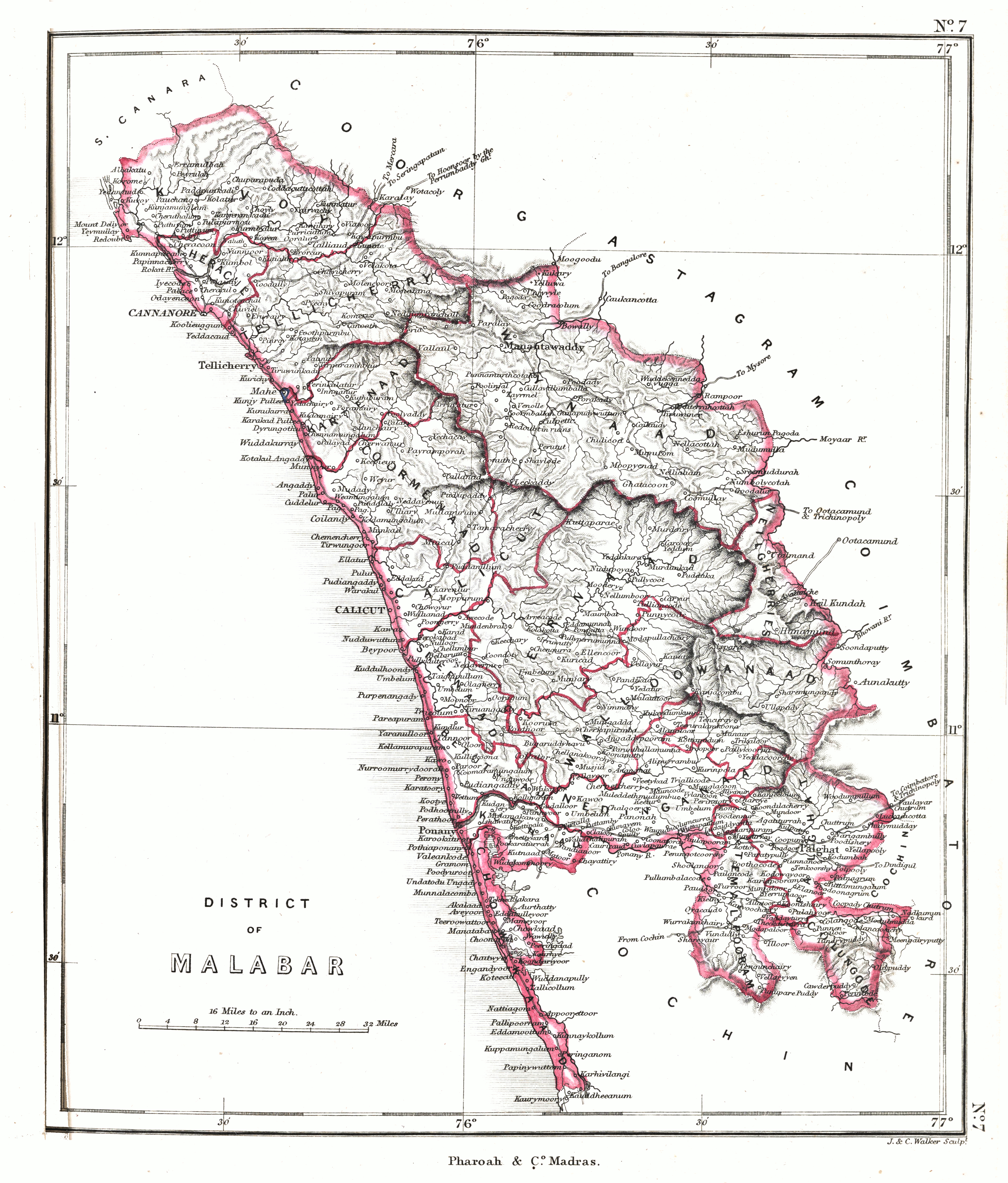 | ५,२५९ × ६,१७१ (१८.२८ MB) | smartcommons>Shyamal | {{Map |Description=Malabar region ca. 1854 |Source=[https://searchworks.stanford.edu/view/12089476 An atlas of the southern part of India : including plans of all the principal towns and cantonments, reduced from the Grand trigonometrical survey of India showing also the Tenasserim Province] |Date=1854 |Author=J. & C. Walker; Pharoah and Co. Madras |Permission={{pd-old-70}} |other_versions= }} Category:Maps of Kerala Category:Maps of South India |
फाइल के उपयोग
कौनों पन्ना नइखे जवन ए फाइल के इस्तेमाल करत होखे।
