चित्र:Mameyes.jpg

ए नमूना के साइज: २२० × १४८ पिक्सेल. अउरी रिजोल्यूशन: ३२० × २१६ पिक्सेल | ८०० × ५३९ पिक्सेल.
ओरिजनल फाइल (८०० × ५३९ पिक्सेल, फाइल साइज: २१३ KB, MIME टाइप: image/jpeg)
| बिबरणMameyes.jpg |
English: Aerial picture of the Mameyes landslide |
||||
| स्रोत | http://www.ngdc.noaa.gov/hazardimages/picture/show/1549 | ||||
| लेखक | R.W. Jibson, U.S. Geological Survey | ||||
| परमीशन (एह फाइल के दुबारा इस्तेमाल) |
|
||||
| Other versions |
Originally from en.wikipedia; description page is (was) here * 11:39, 28 May 2006 [[:en:User:Nilfanion|Nilfanion]] 800×539 (218,573 bytes) * 23:43, 28 November 2005 [[:en:User:Thief12|Thief12]] 400×270 (55,216 bytes) <span class="comment">(http://www.linktopr.com/mameyes.html Aerial picture of the Mameyes landslide Taken by: R.W. Jibson, U.S. Geological Survey)</span> |


Captions
Add a one-line explanation of what this file represents
फाइल के इतिहास
ओ समय ई फाइल कइसन लउके ई देखे खातिर कौनों तारीख/समय पर क्लिक करीं।
| तारीख/समय | चिप्पी रूप | डाइमेंशन | प्रयोगकर्ता | टिप्पणी | |
|---|---|---|---|---|---|
| वर्तमान | ०१:३७, १५ अगस्त २००६ | 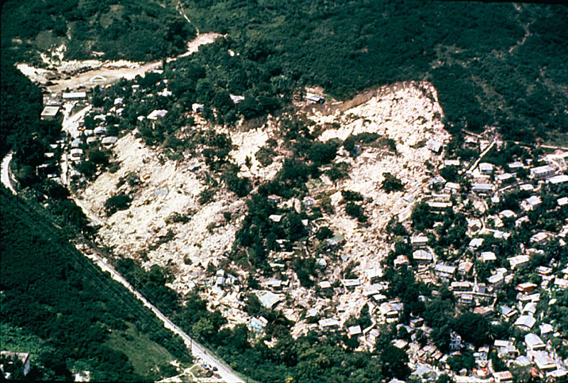 | ८०० × ५३९ (२१३ KB) | smartcommons>Nilfanion | {{Information| |Description= Aerial picture of the Mameyes landslide Taken by: R.W. Jibson, U.S. Geological Survey |Source=http://landslides.usgs.gov/learningeducation/imagepreviews.php |Date= |Author=Users Nilfanion, [[:en:User:Th |
फाइल के उपयोग
कौनों पन्ना नइखे जवन ए फाइल के इस्तेमाल करत होखे।
