चित्र:Manthokha Waterfalls.JPG

ओरिजनल फाइल (५,१८४ × ३,४५६ पिक्सेल, फाइल साइज: ८.१९ MB, MIME टाइप: image/jpeg)

सारांश
| बिबरणManthokha Waterfalls.JPG |
English: Manthokha waterfalls Located in the village of Manthokha Kharmang in District Skardu, Gilgit-Baltistan, this waterfall is famous for its picturesque and spectacular landscape. This is one of the main meccas of the district Skardu welcoming the native as well as international tourists.
The waterfall is in village Manthokha which can be accessed from Skardu city. Heading towards Manthokha Waterfall one has to follow the Kargil-Skardu road from Skardu city. While moving to Manthokha the following villages comes in the way on Kargil-Skardu road: Hussainabad, Thorgo, Parkutta, Ghasing and Manthokha. A stream running downstream falls into the Indus River at Manthokha village. On the east side of this stream is Madhupur, a raod Manthoka-Madhupur road shall lead you to your final destination, Manthokha Waterfall. How to Reached Manthokha WaterFalls Baltistan from Islamabad. By Air. The PIA flight 451 flies to Skardu from Islamabad daily at 10:00 am (usually). It’s a 45 minutes flight, which is well worth the price you pay. During the flight, if you are sitting on the right side, you will see some of the most beautiful mountain ranges from Nanga Parbat, Raka Poshi and also a distant view of the K2, the queen of all mountains.Skardu City is 10 miles from Skardu Airport and when you reached Skardu Bazar you will see Direction to Manthokha. By Road. Manthokha Waterfalls can be reached via Skardu by bus from Islamabad. The drive takes you all the way over the KKH (Karakoram Highway). Since the KKH is still under construction and the Skardu road still has to be repaired, the road can take up to 24 hours by public transport (cost approx. 2500 Rupees). Manthokha Valley is 60km from city of skardu. is located near the confluence of Indus rivers, and is watered by the stream flowing down the Manthokha Nala. Although Manthokha is the base camp for the routes to Sub Division Kharmang. |
| तारीख | |
| स्रोत | आपन रचना |
| लेखक | Rajab Saha |
| Camera location |  | View this and other nearby images on: OpenStreetMap |  35.066627; 75.994227 35.066627; 75.994227 |
|---|

Manthokha Waterfall, Skardu-16300
लाइसेंसिंग


- आप फ्री बानी:
- साझा करे खातिर – रचना के नकल करे, बाँटे आ दुसरी जगह भेजे खातिर
- रीमिक्स करे खातिर – काम के अपनी हिसाब से बनावे खातिर
- नीचे दिहल कारणन की तहत:
- एट्रीब्यूशन – लाइसेंस के कड़ी दे के उचित श्रेय (क्रेडिट) दिहल जरूरी बा आ अगर कौनों बदलाव कइल गइल बा तब ओहू के बतावल जाए के चाहीं। आप ई काम कौनों उचित तरीका से क सकत बानी, बाकी ई न झलके के चाहीं की जेकरा लगे लाइसेंस बा ऊ राउर चाहे राउर काम के समर्थन करत बाटे या सही बतावत बा।
- शेयर अलाइक (share alike) – अगर आप एह सामग्री के आधार बना के कुछ रिमिक्स करत बानी, रूप बदलाव करत बानी, चाहे कुछ जोड़ के सामग्री के बढ़ावत बानी, आपके आपन योगदान ठीक एही या कंपेटिबल लाइसेंस जइसन कि ओरिजनल बाटे, के तहत होखे के चाहीं।

|
This image was uploaded as part of Wiki Loves Earth 2015.
|
 |
Captions
फाइल के इतिहास
ओ समय ई फाइल कइसन लउके ई देखे खातिर कौनों तारीख/समय पर क्लिक करीं।
| तारीख/समय | चिप्पी रूप | डाइमेंशन | प्रयोगकर्ता | टिप्पणी | |
|---|---|---|---|---|---|
| वर्तमान | १८:१२, २२ मई २०१५ | 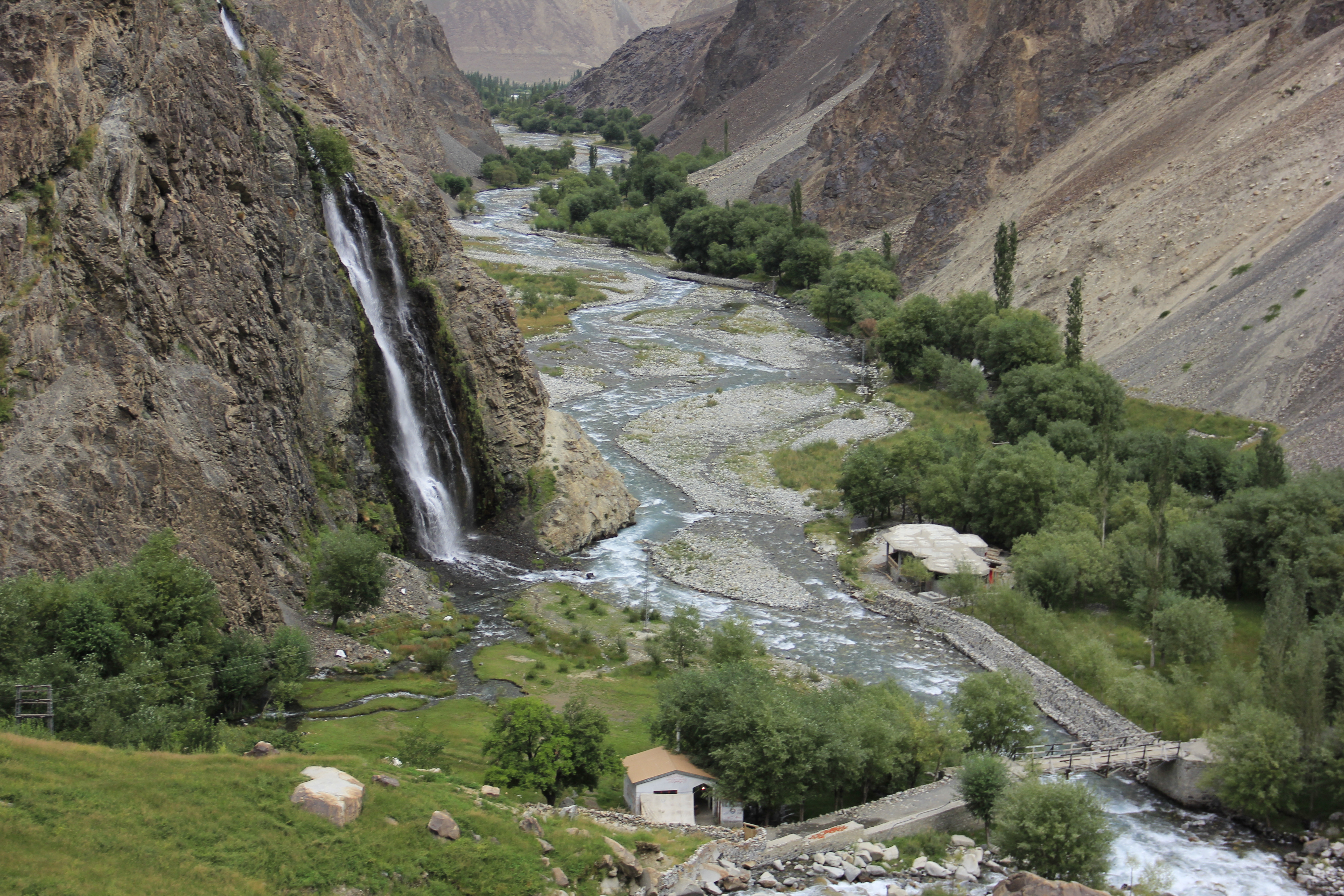 | ५,१८४ × ३,४५६ (८.१९ MB) | smartcommons>Rajab Saha | User created page with UploadWizard |
फाइल के उपयोग
कौनों पन्ना नइखे जवन ए फाइल के इस्तेमाल करत होखे।
