चित्र:Portugues map of India, 1630.jpg

ए नमूना के साइज: २२० × २३८ पिक्सेल. अउरी रिजोल्यूशन: २२२ × २४० पिक्सेल | १,८९३ × २,०४७ पिक्सेल.
ओरिजनल फाइल (१,८९३ × २,०४७ पिक्सेल, फाइल साइज: ४८८ KB, MIME टाइप: image/jpeg)
सारांश
| बिबरणPortugues map of India, 1630.jpg |
English: Detail of India, from a 1630 Portuguese map of Asia, entitled Taboas geraes de toda a navegação, divididas e emendadas por Dom Ieronimo de Attayde com todos os portos principaes das conquistas de Portugal delineadas por Ioão Teixeira cosmographo de Sua Magestade, anno de 1630 (General tables of all the navigation, divided and corrected by D. Jeronimo de Ataide, with all the ports and conquests of Portugal delineated by Joao Teixeira, cosmographer of His Majesty, Year 1630" |
| स्रोत | Taboas geraes de toda a navegação |
| लेखक | Jeronimo de Ataide, João Teixeira |
लाइसेंसिंग
|
This is a faithful photographic reproduction of a two-dimensional, public domain work of art. The work of art itself is in the public domain for the following reason:
The official position taken by the Wikimedia Foundation is that "faithful reproductions of two-dimensional public domain works of art are public domain". This photographic reproduction is therefore also considered to be in the public domain in the United States. In other jurisdictions, re-use of this content may be restricted; see Reuse of PD-Art photographs for details. {{PD-Art}} template without license parameter: please specify why the underlying work is public domain in both the source country and the United States
(Usage: {{PD-Art|1=|deathyear=''year of author's death''|country=''source country''}}, where parameter 1= can be PD-old-auto, PD-old-auto-expired, PD-old-auto-1996, PD-old-100 or similar. See Commons:Multi-license copyright tags for more information.) | |||||


फाइल के इतिहास
ओ समय ई फाइल कइसन लउके ई देखे खातिर कौनों तारीख/समय पर क्लिक करीं।
| तारीख/समय | चिप्पी रूप | डाइमेंशन | प्रयोगकर्ता | टिप्पणी | |
|---|---|---|---|---|---|
| वर्तमान | १३:४७, २४ जून २०१० | 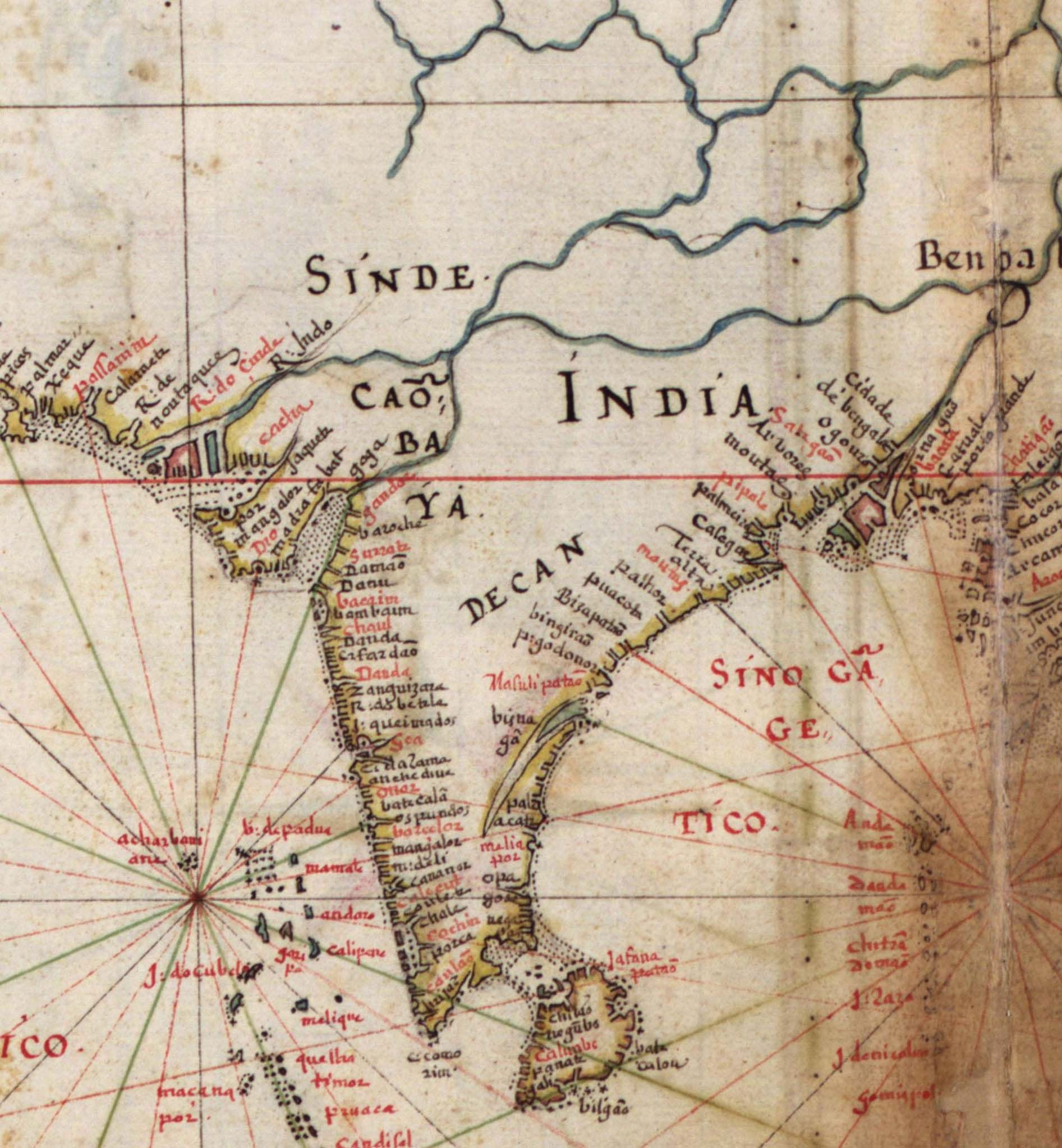 | १,८९३ × २,०४७ (४८८ KB) | smartcommons>Walrasiad | {{Information |Description={{en|1=Detail of India, from a 1630 Portuguese map of Asia, entitled Taboas geraes de toda a navegação, divididas e emendadas por Dom Ieronimo de Attayde com todos os portos principaes das conquistas de Portugal delineadas por |
फाइल के उपयोग
कौनों पन्ना नइखे जवन ए फाइल के इस्तेमाल करत होखे।
