चित्र:Schematic Map of Andamanese Languages & Tribes.png

ए नमूना के साइज: १८२ × ३२९ पिक्सेल. अउरी रिजोल्यूशन: १३३ × २४० पिक्सेल | ८६० × १,५५५ पिक्सेल.
ओरिजनल फाइल (८६० × १,५५५ पिक्सेल, फाइल साइज: ४५ KB, MIME टाइप: image/png)
सारांश
| बिबरणSchematic Map of Andamanese Languages & Tribes.png |
English: Schematic Map based from the time of British Annexation (1851), along with current cities and the Andaman GT Road. |
||
| तारीख | |||
| स्रोत | Own work. Created in Illustrator, based on this map by Ko'oy. | ||
| लेखक | Rasagy Sharma | ||
| Other versions |
|


लाइसेंसिंग
I, the copyright holder of this work, hereby publish it under the following license:


ई फाइल Creative Commons Attribution-Share Alike 3.0 Unported लाइसेंस की तहत लाइसेंसी बा।
- आप फ्री बानी:
- साझा करे खातिर – रचना के नकल करे, बाँटे आ दुसरी जगह भेजे खातिर
- रीमिक्स करे खातिर – काम के अपनी हिसाब से बनावे खातिर
- नीचे दिहल कारणन की तहत:
- एट्रीब्यूशन – लाइसेंस के कड़ी दे के उचित श्रेय (क्रेडिट) दिहल जरूरी बा आ अगर कौनों बदलाव कइल गइल बा तब ओहू के बतावल जाए के चाहीं। आप ई काम कौनों उचित तरीका से क सकत बानी, बाकी ई न झलके के चाहीं की जेकरा लगे लाइसेंस बा ऊ राउर चाहे राउर काम के समर्थन करत बाटे या सही बतावत बा।
- शेयर अलाइक (share alike) – अगर आप एह सामग्री के आधार बना के कुछ रिमिक्स करत बानी, रूप बदलाव करत बानी, चाहे कुछ जोड़ के सामग्री के बढ़ावत बानी, आपके आपन योगदान ठीक एही या कंपेटिबल लाइसेंस जइसन कि ओरिजनल बाटे, के तहत होखे के चाहीं।
Captions
Add a one-line explanation of what this file represents
A schematic map of Andamanese languages and tribes, 1851.
फाइल के इतिहास
ओ समय ई फाइल कइसन लउके ई देखे खातिर कौनों तारीख/समय पर क्लिक करीं।
| तारीख/समय | चिप्पी रूप | डाइमेंशन | प्रयोगकर्ता | टिप्पणी | |
|---|---|---|---|---|---|
| वर्तमान | १६:५८, १० अगस्त २०१३ | 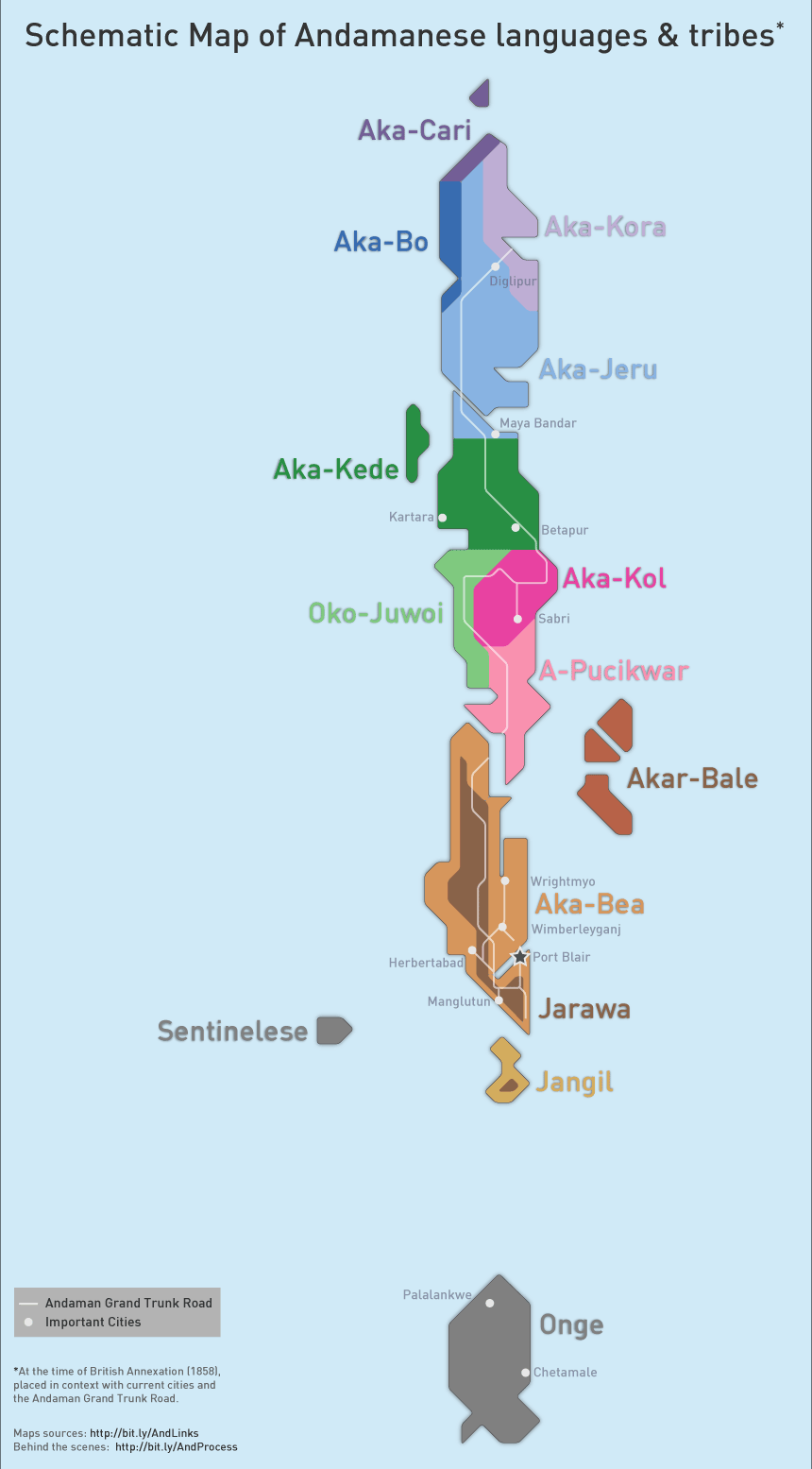 | ८६० × १,५५५ (४५ KB) | smartcommons>Rasagy | User created page with UploadWizard |
फाइल के उपयोग
कौनों पन्ना नइखे जवन ए फाइल के इस्तेमाल करत होखे।
