चित्र:Spice Islands (Zanzibar highlighted).svg
.svg)
Size of this PNG preview of this SVG file: २२० × २७१ पिक्सेल. अउरी resolution: १९५ × २४० पिक्सेल.
ओरिजनल फाइल (एसवीजी फाइल, नॉमिनली ७१३ x ८७९ पिक्सल, फाइल के आकार: ११ KB)
 Any autoconfirmed user can overwrite this file from the same source. Please ensure that overwrites comply with the guideline.
सारांश
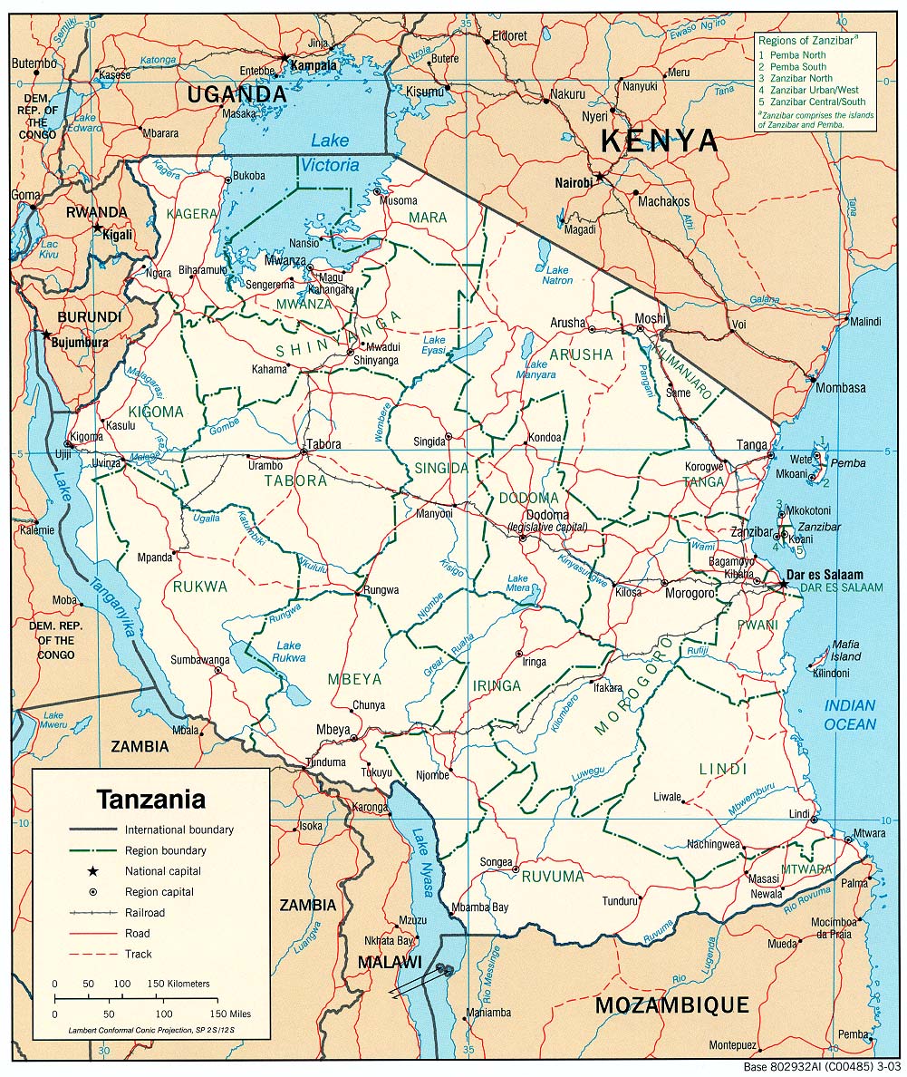
| बिबरणSpice Islands (Zanzibar highlighted).svg | Part of the map of Tanzania, showing the Spice Islands, and highlighting Zanzibar. |
| तारीख | |
| स्रोत | Vectors self-made in Inkscape. Source was cropped from 2003 Political map of Tanzania at Perry-Castañeda Library Map Collection — Tanzania. The maps are attributed to the US Central Intelligence Agency. |
| लेखक | Mysid |
| Other versions |
Derivative works of this file: Image:Spice Islands (Tanzania).svgin French : Image:Spice_Islands_Tanzania-fr.svg in French : Image:Spice_Islands-Zanzibar_highlighted-fr.svg in Arabic: Image:Spice Islands (Zanzibar highlighted)-ar.svg |
| SVG genesis InfoField |


.svg)
_el.svg)
_sv.svg)
.svg)


-ar.svg)

लाइसेंसिंग
| Public domainPublic domainfalsefalse |

|
I, the copyright holder of this work, release this work into the public domain. This applies worldwide. In some countries this may not be legally possible; if so: I grant anyone the right to use this work for any purpose, without any conditions, unless such conditions are required by law. |
Captions
Add a one-line explanation of what this file represents
Map of Zanzibar
फाइल के इतिहास
ओ समय ई फाइल कइसन लउके ई देखे खातिर कौनों तारीख/समय पर क्लिक करीं।
| तारीख/समय | चिप्पी रूप | डाइमेंशन | प्रयोगकर्ता | टिप्पणी | |
|---|---|---|---|---|---|
| वर्तमान | २३:२७, २ नवंबर २०२४ |  | ७१३ × ८७९ (११ KB) | smartcommons>Dchestnykh | Redo the previous version in vector |
फाइल के उपयोग
कौनों पन्ना नइखे जवन ए फाइल के इस्तेमाल करत होखे।
.svg)